July 15-16

This is the last hike and I am officialy caught up! Yea!
Ok, this is another not really a hike, but sort of and I have really cool pictures. My mom and I took the train up to Vancouver B.C. for two days earlier this month. We stayed in a really nice hotel in the middle of downtown. The fact that we had to walk a little more than a half mile dragging luggage (ok, my mom drug the luggage) just to get to our hotel from the train station classifies this as an "official" hike. We spent a lot of the time just walking around downtown and relaxing in the hotel.
 Then on the second day we went to the park.
Vancouver has a huge park (the perimeter trail is about 10km). We walked down to the park, and then walked around in it. There was a lake, a rose garden, and most of the edges of the park is water, so there were lots of ocean views. One of the things I really wanted to see was "The Girl in the Wetsuit" which is supposed to be similar to the famous "The Little Mermaid" statue in Europe. You can see how the tide comes all the way up to her feet.
 For some reason, I just didn't have a lot of energy that day (maybe it was the big breakfast) so we decided to take a free trolley around the perimeter. That ended up being just about as much work because the trolley was so crowded we had to stand. I wedged myself into a window and held on, and my mom was out in the middle holding on to a bar overhead. But, we made it, and then walked back up the hill to our hotel, and then back to the train station with luggage in tow.
As you can probably guess, we were exhausted on the train trip back, but trains are so much more comfortable than planes or even cars really because you get so much more leg room, and can get up and walk around if you want. This was a really fun, although short, trip!

My mom is going to kill me, but this is the only picture I got of her that is even sort of in focus.

So, I don't know if I'm going to be able to go out this weekend. If not, the next pictures you will see will be of Yellowstone!


 this is what it used to look like
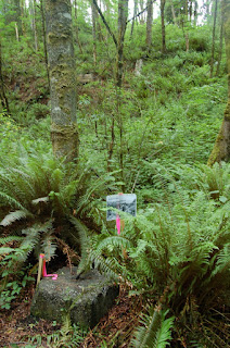


 (like the "vintage" look?)
 This hike has it all: waterfalls, groves of different trees, wildlife, drop offs, strange trees, wildflowers, strange plants... After quite awhile on the trail I was getting really tired and started to wonder how much further it was. I started the "just until that tree up ahead" and finally came to a crossroads. The sign post said Poo Poo Point was .5 miles further. It also said that the trailhead was 4 miles back! Well, I couldn't come this far and miss it by just a half mile, so I kept going, and I am so glad I did. The view was breathtaking and there were all these parasailers using the point as a take-off spot. So I sat up there for about a half-hour just watching them take off and land. I also discovered that you can drive up to the point! I guess I'm kinda glad I didn't know that before hand, because then I couldn't say I made it.

